

Hill bag all 92
historic county tops
of the united kingdom
Join now for free
Get ready to conquer all of the peaks of the United Kingdom’s historic counties
A detailed summary of each mountain top is provided. Used as a reference guide, here, you will find important stats, a summary on how to reach the summit and a map displaying the exact location. Allowing you to easily plan your trip and hill bag each of the 92 historic county tops of the United Kingdom.
To make it more fun, when you’ve completed a summit you will gain a badge. You can also fill in a field report and upload a photo of your ascent and share your experience with others.
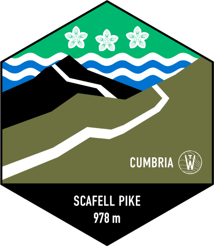
Join for FreeScafell Pike
With an elevation of 978 m (3,209 ft), Scafell Pike is well-known for being the tallest mountain in England. Scafell Pike is located in the renowned Lake District National Park and makes up part of the Southern Fells, Cumbria. Neighbouring civil parishes of Wasdale, Borrowdale, Eskdale, and Langdale all provide excellent starting points to reach the summit.
Lord Leconfield donated the surrounding land around the peak to the National Trust in 1919 to honour all those who served in the Great War. The summit is made up of rough crags; a large cairn also holds England's highest memorial plaque. The peak is one out of the three climbed when taking part in the popular Three Peaks Challenge.
| landscapeHeight | language Country | trip_originRegion |
|---|---|---|
| 978 m (3,209 ft) | England | Cumbria |
| gps_fixedLat/Lng | placeGrid Ref | mapOS Map |
| 54.45429993,-3.21161272 | NY 2154 0721 | OL6: English lakes |
92 Historic Counties
Since the middle ages the ninety-two historic counties of England, Wales, Scotland and Northern Ireland once formed the geographical reference frame of the country for over one-hundred years.
It was these historic counties that laid the foundation, developing strong individual communities with a deep-rooted history. Each bringing into existence their own identities, different cultural traits, differing architecture, dialect, food, sporting organisations, and numerous traditions.
| Name | Elevation | County | Complete | |
|---|---|---|---|---|
| Bushey Heath | 154 m (505 ft) | Middlesex | edit | |
| Whernside | 736 m (2,415 ft) | Yorkshire West Riding | edit | |
| Mickle Fell | 788 m (2,585 ft) | Yorkshire North Riding | edit | |
| Bishop Wilton Wold | 246 m (807 ft) | Yorkshire East Riding | complete | |
| Worcestershire Beacon | 425 m (1,394 ft) | Worcestershire | complete | |
| Milk Hill | 294 m (965 ft) | Wiltshire | complete |
Track Your Peak Bagging Progress
The historic county tops of the United Kingdom, encompassing the countries of England, Scotland, Wales and Northern Ireland, are a diverse range of peaks, varying in both height and difficulty. From a meagre 80 meters at Boring Field in Huntingdonshire to heights of 1,345 meters on Ben Nevis in the Scottish Highlands, you can easily start with the closest one to you in your own county.
Admittedly, some will leave you more breathless than others, but it is a great way to see areas of the UK that you may otherwise neglect to visit.
An incredible feat and a rewarding experience
To help you complete this monumental task of reaching each summit, you can easily track your progress by completing your own personal log table and watch your progress grow through charts.
Join for Free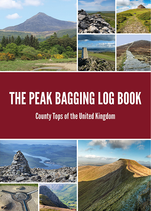
£12.95Add to basket
Buy the Printed Version Now!
Would you prefer a printed copy to take with you whilst out on the trails?
To help you undertake a challenge like no other, this book provides a fantastic way of keeping a track record of how and when you have reached the highest point, in not just historic but administrative counties also, totalling 108 counties in total. Each county top is listed in order from highest to smallest, providing stats, a short bio, and log to fill in, allowing you to tick off every county top once you have reached each summit.
Get ready to embark on your own adventure and let us be there to help you along the way. Have fun!